July 12 – 16, 2026 · Mount Vernon → Arlington, WA
4
Days Flying
3
Airports
10,778
Ft Baker
Tent
Camp Nights
The North Cascades Fly Camp XC is a multi-day guided cross-country expedition through one of the most dramatic flying corridors in the Pacific Northwest. Pilots are picked up from the hotel and driven to a private ranch LZ in Mount Vernon for mission briefing — this is where the group meets, gear is checked, and the route is walked in detail before anyone touches a motor.
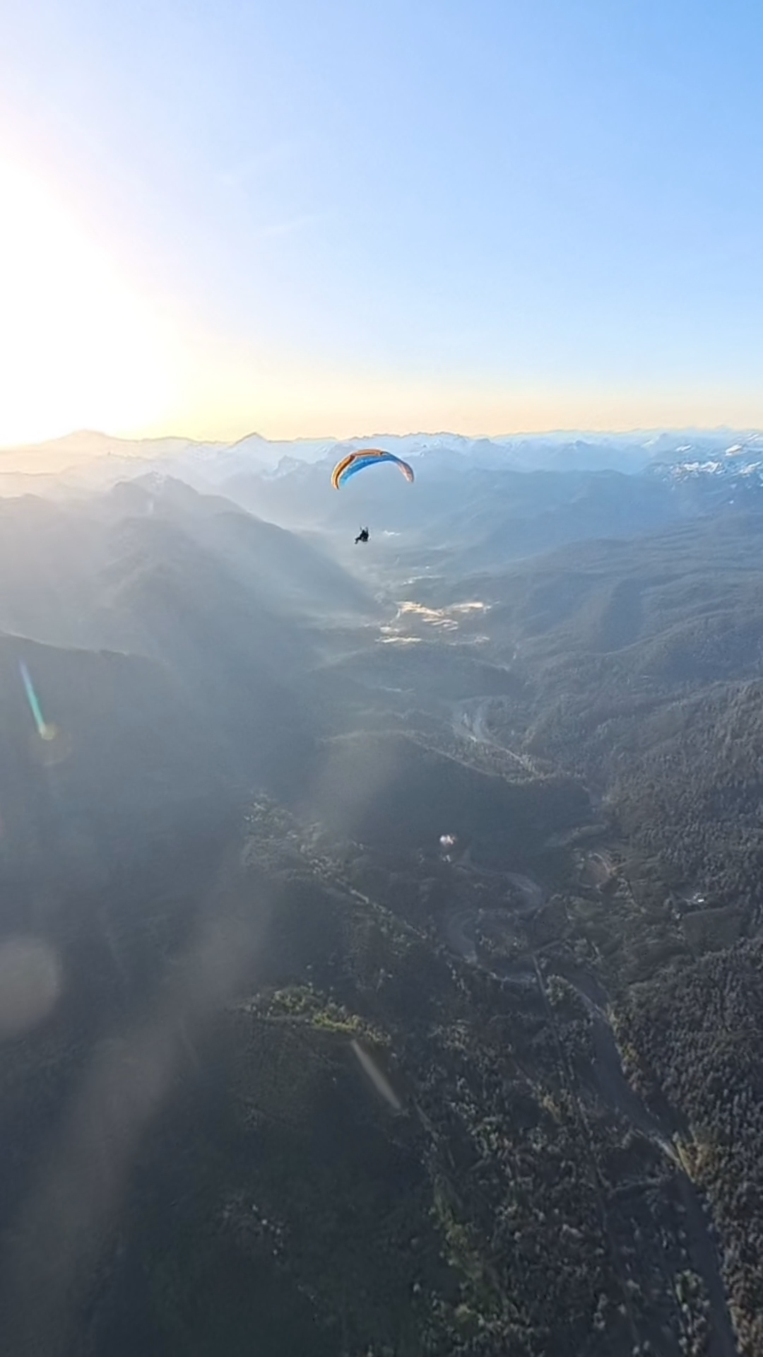
Day one launches from the ranch and follows the Skagit Valley north to Concrete Airport for fuel and a tent camp night in the shadow of the North Cascades. Day two is the centrepiece — a push northeast toward Mount Baker to take in the glaciers and Baker Lake, then a long southern run down the Sauk River valley to Darrington Airport for a second night under canvas. The final flying day brings the group south to Arlington Airport, one of the most celebrated paramotor destinations in Washington, before a shuttle returns everyone to the Tulalip Hotel for a proper last night. Departure the following morning.
Three flying days, three iconic Cascade locations, two nights camping at working airports, one night at the hotel. Spots are capped at eight pilots. Everyone flies together and no one gets left behind.
Arrival Day
Pilots are collected from the hotel and driven to a private ranch landing zone outside Mount Vernon. This is mission briefing day — route walkthrough, gear inspection, weather expectations, and group introductions. No flying. Early night. The motors go out tomorrow.
Day 1 — Morning
First launch of the trip from the ranch LZ. The Skagit Valley floor is wide and flat with reliable morning conditions. The route heads northeast following the valley toward the mountains. Concrete is visible ahead long before you arrive.
Day 1 — Afternoon
The first stop is Concrete Airport, a small grass field sitting at the foot of the North Cascades. Fuel is taken on here. Tonight the group camps in private tents on the field — the mountains are immediately to the north and the Skagit River is close. This is proper adventure camping, not glamping.
Day 2 — Morning
The day's first objective is Mount Baker — a 10,778 ft active stratovolcano covered in more glacial ice than any other Cascades peak outside Rainier. The route climbs to gain views of the Coleman, Easton, and Roosevelt glaciers before swinging south over Baker Lake, a deep glacial reservoir in the Baker River valley. The colour of the water from altitude is not something you forget.
Day 2 — Afternoon
From Baker Lake the route drops south following the Sauk River — old-growth forest, gravel bars, and clear glacier-fed water for the full descent. The river corridor is one of the most scenic low-altitude legs of the trip. The group lands at Darrington Airport, a small working airfield in a tight valley ringed by peaks. Second night in private tents at the field.
Day 3 — Morning
The final flying leg follows the Stillaguamish River valley southwest out of the mountains and into the flatlands, finishing at Arlington Municipal Airport — one of the most active paramotor destinations in Washington state. A proper runway, a proper arrival, and the feeling of having crossed something real.
Day 3 — Evening
After landing at Arlington, gear is packed and the group shuttles to the Tulalip Hotel for the final night — a real bed, a real shower, and time to decompress over dinner. The flying is done. The stories start here.
Departure Day
Morning shuttle from the Tulalip Hotel to the airport. Checkout, farewells, and departure. The track log from the last three days will look better than anything you have ever uploaded.
Mount Vernon ranch LZ — private Skagit Valley field, mission briefing point and first launch
Skagit Valley corridor — flat agricultural valley floor with consistent morning thermals and mountain views on all sides
Concrete Airport — small grass field at the mountain gateway, fuel stop and first camp night
Mount Baker glaciers — Coleman, Easton, and Roosevelt glaciers on a 10,778 ft active volcano, viewed from altitude on day two
Baker Lake — deep glacial reservoir in the Baker River valley, turquoise water visible end-to-end from cruise altitude
Sauk River canyon — glacier-fed river through old-growth forest, low-altitude glide on the southern leg of day two
Darrington Airport — remote mountain airfield ringed by peaks, second camp night
Stillaguamish River valley — the final descent corridor from mountains to flatlands leading to Arlington
Arlington Municipal Airport — storied paramotor destination, finish line of the flying route
The North Cascades corridor is one of the most biodiverse mountain ecosystems in North America. At altitude you are inside it, not looking at it through glass.
Bald & golden eagles
Both species nest throughout the corridor. Thermal columns along the ridge crossings put pilots at eye level with soaring raptors most mornings.
Black bear
Frequent sightings in the Suiattle River valley and lower alpine meadows, especially in berry season. Visible from cruise altitude without disturbance.
Roosevelt elk
Large herds move through the old-growth river bottoms below the Glacier Peak wilderness. Early morning launches often catch them in open meadows.
Mountain goat
Found on the exposed ridge faces above 6,500 ft near Three Fingers and Glacier Peak. Occasionally visible on rock faces during the high crossings.
Gray wolf
The North Cascades pack range covers this corridor. Unlikely but possible — a sighting from altitude is one of those moments that stays with you.
Osprey & great blue heron
Common along every river segment. Osprey are aggressive about their airspace — expect close passes near the Suiattle and Sauk rivers.
Mount Rainier
On clear days visible from over 150 miles at cruise altitude — a 14,411 ft volcano floating above the horizon to the south. Nothing prepares you for the scale of it.
Glacier Peak
One of the most remote stratovolcanoes in the lower 48. You fly past its flanks. The permanent snowfields are blinding white against the blue sky above timberline.
Ross Lake
A 24-mile glacial reservoir on the US-Canada border. The water is turquoise from glacier flour. Visible directly below for several miles of the northern leg.
Hozomeen Mountain
Twin granite peaks above the camp at the Canadian border. From the LZ they look close enough to touch. At sunset the light on the north face turns orange.
The Picket Range
One of the most technical alpine zones in the Cascades — sheer north faces and permanent ice — visible to the west on the final day approach.
Old-growth cedar canopy
The Suiattle River canyon holds some of the largest western red cedars in the state. At low altitude the canopy scale is disorienting — trees that have been there for 800 years.
Private tents at the airfield with the North Cascades directly overhead. The support vehicle is on site. Gear stays with you. This is the real thing — sleeping next to your paramotor at a mountain airport the night before a Baker Lake run.
Second camp night at Darrington Airport, a small field in a tight Cascade valley. Mountains on every side, the Sauk River nearby. Private tents are set up before pilots arrive. Camp fire, debrief, and an early night before the final flying day.
After landing at Arlington, the group shuttles to the Tulalip Hotel for the final night. Real bed, hot shower, proper dinner. The shuttle to the airport for departure leaves the following morning.
All meals are covered from arrival day dinner through breakfast on departure day. Camp mornings are hot coffee, eggs, and oats from the support trailer. Packed lunches are prepared each morning before launch. Dinners at the airport camps are cooked on site — real food, not freeze-dried. The Tulalip Hotel dinner is on your own. Dietary requirements accommodated with advance notice.
Every pilot on this route flies with a full safety net behind them. This is not a self-guided trip.
PPG4-rated lead pilot with 2,000+ XC hours in the Cascades. Flies point and sets the pace.
Second certified instructor flies tail-end Charlie. No pilot is ever ahead of lead or behind sweep alone.
A dedicated support vehicle shadows the route on accessible roads carrying fuel, spare parts, first aid, and emergency shelter.
Every pilot carries a Garmin inReach. Lead guide monitors all tracks in real time via satellite messenger.
If conditions are below minimums at brief time, the day is scrubbed. No exceptions, no pressure, no majority votes.
PPG3 rating minimum, 50+ logged solo hours, current gear inspection within 12 months. Non-negotiable.
2026 — Session 1
July 12 – July 16, 2026
3 spots remaining
2026 — Session 2
August 9 – August 13, 2026
8 spots available
A 10% deposit ($682) holds your spot. The remaining balance is due in full two months before the event date. Paramotor rentals require a separate refundable insurance deposit.
All-Inclusive Trip Fee
$6,820
per pilot · deposit $682
Also Included
Not Included
Paramotor Rental Add-On
$250
+ refundable insurance deposit
Full multi-day paramotor and wing rental, inspected and test-flown by staff prior to the event. Limited units available — request at time of registration.
Eight pilots max. Spots fill fast. Request an invite and we'll reach out within 48 hours.
SEATTLE PARAMOTOR
© 2026 Seattle Paramotor. All rights reserved.